Putting the WE in WET—What Employee-Ownership Means to Us As we celebrate Employee Ownership Month, we reflect on what it means to be an employee-owner and work for a company that is 100% employee-owned. Casselbury (2018) states, “An employee-owned company plan is more commonly referred to as an ‘employee stock […]
What do you do at WET?
Senior Engineer responsible for development (residential and commercial) and utility projects (water, sewer, storm water, sitework, etc)
How long have you been in the industry? How long with WET?
I have been an engineer for 15 years, this is my 7th year at WET.
What is the most satisfying part of your job?
I like the challenge and variety of projects I get to work on with WET. I have been very fortunate to work with great clients and colleagues at WET.
What do you do in your spare time?
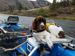
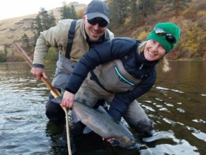
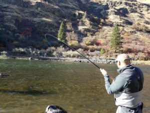
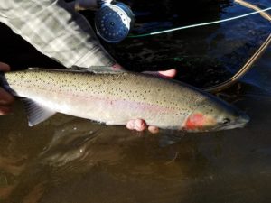
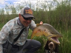
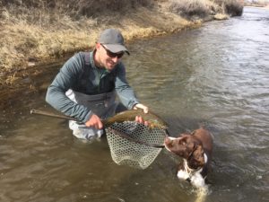
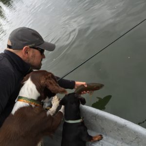
I serve as Vice President of the George Grant Chapter of Trout Unlimited and have been on the board for 5+ years. I am a licensed MT fishing guide and am guiding many of the weekends during the peak fishing season. When I am not working, I enjoy spending my spare time fishing with my lovely wife, Angela, and our four-legged children (Drake and Cooper). When I can’t be on the water, I spend my spare time tying flies and designing flies for CATCH Fly Fishing.
What is an interesting/obscure fact about yourself?
I used to be a pretty darn good trumpet player. Other than that, I am not really that interesting.
Title: Intern.
Job: I wear a lot of different hats at WET to fill whatever role I can. Sometimes I accompany an engineer into the field and help them with well sampling or surveying. Sometimes I build things that need to be built, or fix things that need to be fixed. Sometimes I’m given raw computer data and asked to put it into a more manageable form. Ultimately, everything that I do helps build the experience I’ll need to make the transition to engineer-in-training.
How long have you been in the industry? How long with WET?
This is my third year as an environmental intern, and my second with WET.
What is the most satisfying part of your job?
The dynamism – I never feel bored at work! Very rarely is anything that I do exactly like something I’ve done before. Every day I get to expand my knowledge of, and experience in, the consulting world.
What do you do in your spare time?
Since I’m still a student, spare time is sometimes tough for me to come by! But I usually fill my open days with reading and photography. During the summer, I try to go to as many concerts as I can.
What is an interesting/obscure fact about yourself?
In 8th grade, I taught myself how to write backwards, so the paper could be read normally on the other side when held up to a light. I still do it from time to time.
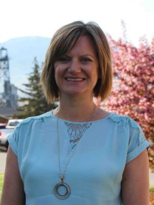
I am an Administrative Assistant with many time sensitive responsibilities. My job description is vast, but the most important duties entail greeting clients, assisting engineers with various reporting tasks and managing our vehicle fleet. I take care of the daily mail as well as accounting functions. I also schedule meetings, luncheons, and travel arrangements. Purchasing is also one of my important responsibilities.
How long have you been in the industry? How long with WET?
I have been in the engineering industry for two years and have worked at WET during this time.
What is the most satisfying part of your job?
The most satisfying part of my job is working with a great crew and meeting clients.
What do you do in your spare time?
In my spare time, I enjoy all that Montana has to offer. I spend time at my family cabin. I love hiking, fishing and whitewater rafting on the Lochsa River. I also enjoy time with my husband as well as my amazing friends and family. I especially love spending time with my grandkids. I strive for toxic free living and work with essential oils. I also can be found at canvas art classes with my friends. Along with my husband and friends, I am a frequent music concert goer. I volunteer with activities that draw attention and money to organizations that are dear to my heart such as the American Foundation for Suicide Prevention (AFSP), Big Brothers Big Sisters Bowl for Kids’ Sake and the United Way. With my WET team, I join in decorating a Christmas tree each year for the Festival of Trees in which the proceeds go to our women’s shelter, Safe Space. And last but not least, if ever in Vegas, I’m a Blackjack gal. 😊
What is an interesting/obscure fact about yourself?
A fact about myself is that the rock band, Journey has been my all-time favorite band since I was twelve years old. I am a Journey junkie!
January 1, 2018 was not only New Year’s Day, but day one of the new Montana Pollutant Discharge Elimination System (MPDES) Construction General Permit, referred to as the CGP.
When is a CGP needed?
If both of the following two criteria are met:
1. There are areas of ground disturbance or other potential pollutant sources due to the construction activity where a storm water discharge to state surface water can occur.
2. The construction activity has a total area of ground disturbance through clearing, excavating, grading, or placement/removal of earth material which is equal to or greater than one acre
This new CGP is a big deal because there are some changes in both the paperwork and procedures.
PERMIT HIGHLIGHTS
-The form Storm Water Pollution Prevention Plan (SWPPP) is shorter, 10 pages versus 19 pages.
-Checklists are used to identify ‘potential pollutants’, ‘BMPs’, ‘major construction activity’, and ‘BMP phasing.’
-There are three choices on how to revise the SWPPP (revise SWPPP and site maps, use inspection reports and revise site maps, and updates in a log and revise site maps.
-Inspections can be delayed if severe winter conditions occur.
-Public signage is required beginning in 2021.
WHAT does the new CGP mean for construction projects that were started last year but not ready to be closed?
You need to submit a renewal. A renewal consists of an NOI and SWPPP. Additional fees are not needed AT THIS TIME.
WHO provides that service?
WET will gladly prepare renewal packages. We have an interview form with all the required site information identified.
WHY can’t I take care of the renewal myself?
You can if you are a certified SWPPP Administrator and your certification is current.
WHERE can I get recertified?
WET will gladly help (are you sensing a pattern here?) WET is one of the ‘acknowledged training provider by the state of Montana’. That means we provided a curriculum to the state, which was reviewed and approved for:
-BMP 201 SWPPP Preparer and Administrator Certification Program and
-BMP 201-R SWPPP Preparer and Administrator Recertification Program.
WHEN are trainings scheduled?
Our 2018 schedule will be announced soon.
Stay tuned!
Water & Environmental Technologies, Inc. (WET) is excited to announce the hiring of Rich West, PE and Shawn Arthur, PE in its Great Falls, Montana office. “We are very pleased to have acquired professionals of Rich and Shawn’s caliber. WET is committed to growing its presence in the Great Falls region,” said Josh Vincent, Vice President of WET.
Rich is the Great Falls Office Manager and a Senior Civil Engineer with over thirty years of experience in consulting engineering. He specializes in project management, transportation engineering, drainage, site development, and municipal engineering. Rich provides services to a large variety of clients including local, state, tribal and federal entities along with industrial clients and private developers. Rich graduated with a Bachelor of Science in Civil Engineering from Montana State University. He is a Registered Professional Engineer in the State of Montana (#8626PE).
Shawn is a Senior Civil Engineer and has worked in the civil engineering consulting industry since 1993. He has significant project management experience encompassing municipal subdivision development; storm water master planning and modeling; storm water interceptor and collector pipeline design; sanitary sewer collection system and pump station design; waste water treatment system design; municipal water treatment, pumping, storage, transmission and distribution system design; environmental permitting; industrial and commercial civil site development; industrial and residential street and parking facilities; ADA compliant municipal sidewalk design and construction administration . Shawn serves as a project manager, construction administrator and engineer on numerous municipal water, sewer and storm drain infrastructure projects; land development and annexation projects and municipal infrastructure master planning projects.
Shawn has experience working with small private developers, nationwide commercial developers and governmental entities ranging from the smallest unincorporated communities to Federal Military Bases, municipalities, and state transportation departments. Shawn graduated with a Bachelor of Science in Civil Engineering from Montana State University. He is a Registered Professional Engineer in the State of Montana (#11007PE).
WET is a regional environmental and civil engineering consulting firm with offices in Butte, Anaconda, Great Falls, and Bozeman, Montana. You can reach our Great Falls office at 406-761-2290.
In July 2017, Water & Environmental Technologies (WET) merged with Bozeman engineering consultants Nicklin Earth & Water (NE&W). NE&W has been in business in Bozeman since 1995 offering professional environmental, hydrologic, and Bozeman engineering services to clients in the region. NE&W is known for performing environmental investigations and developing remedial alternatives for the Bozeman Solvent […]
Spurred by the release of 1.1 billion gallons of coal ash slurry from a surface impoundment at the Tennessee Valley Authority’s Kingston, TN plant, the EPA proposed two regulatory options in 2010 to address potential risks to human health and the environment from the mismanagement of Coal Combustion Residuals (CCR).
The two regulatory options were structured separately, one under RCRA Subtitle C and the other under RCRA Subtitle D. The Subtitle C regulation proposed to categorize CCR as a hazardous waste, and require CCR generators to dispose of it as such. The Subtitle D regulation proposed to establish national standards for landfills and surface impoundments that receive CCR while maintaining them under a solid waste categorization.
In 2015, Coal-Fired Power Plants supplied approximately 33% of U.S. electric power.
The United States possesses more recoverable coal reserves than any other country in the world. Of the U.S. endowment, some of the cleanest and most accessible reserves are found in the Rocky Mountain and Great Plains Region, characterized by subbituminous low-sulfur deposits that lie in thick, near-surface beds, offering substantially greater ease of access than Appalachian coal.
The Powder River Basin in Wyoming and Montana alone contributed over 40% of coal mined in the U.S. in 2011. Rocky Mountain and Great Plains coal deposits, comprised of the Power River Basin deposit, along with similar deposits in Montana, North Dakota, Wyoming, Colorado, and Utah, account for nearly 50% of U.S. coal reserves.
According to the 2015 U.S. Annual Coal Report published by the U.S. Energy Information Administration, surface coal mining operations, located predominantly in the aforementioned region, provided between 26,000 and 37,000 U.S. jobs.
Not only do Rocky Mountain and Great Plains coal reserves include a valuable portion of U.S. natural resources, but they also supply a significant percentage of U.S. energy and numerous jobs. Amidst a rebounding U.S. job market and economy, these resources and job numbers mean a great deal.
Mismanaged Coal Combustion Residuals (CCR) can pose a widespread threat to human health and the environment.
Coal ash, produced from the combustion of coal for power generation, contains elements such as arsenic, cadmium, and mercury. Although these heavy metals are naturally occurring elements found throughout the earth’s crust, mismanaging high-level concentrations, typically of anthropogenic origin, can easily contaminate groundwater, surface water, and the air.
Arsenic, cadmium, and mercury exposure, even at low levels, has been linked to multiple-organ systemic damage. Additionally, all three are either known or probable human carcinogenic (cancer-causing) agents. Consequently, attentive handling and disposal practices are essential to the mitigation of potential health and environmental risks.
In December of 2014, after eight public hearings and countless public comments, the “Final Rule: Disposal of Coal Combustion Residuals from Electric Utilities” proposed under RCRA Subtitle D, was signed. This new set of standards was entered in to the Federal Register on April 17, 2015.
The Final Rule established technical site requirements for both new and existing CCR landfills and surface impoundments to address the primary risks associated with the storage and disposal of coal combustion residuals. These technical requirements address several components:
- Reducing the Risk of Catastrophic Failure
- Protecting Groundwater
- Operating Criteria
- Record Keeping, Notification, and Internet Posting
- Inactive Units
- State Programs
- Closure
- Beneficial Use
Although the more lenient of the two EPA-proposed regulations was used to structure the Final Rule, the technical requirements are stringent, and call for closure of any units that are noncompliant.
To effectively and economically utilize our valuable coal reserves while protecting human health, the environment and our job economy, strategic planning and careful attention to detail is imperative during every step in the process. From well-structured permitting to deliberate design and rigorous monitoring, every detail is vital.
The Final Rule: Disposal of Coal Combustion Residuals from Electric Utilities can be found here:
httpss://www.epa.gov/coalash/coal-ash-rule
A summarized Fact Sheet for the Final Rule on Disposal of Coal Combustion Residuals from Electric Utilities can be found here:
httpss://www.epa.gov/sites/production/files/2014-12/documents/factsheet_ccrfinal_2.pdf
WET’s permitting, environmental, and engineering team has extensive experience dealing with responsible CCR management at large coal-fired power plants; including landfill and surface impoundment permitting, well installation and monitoring, and periodic reporting.
Contact our team to ensure that all projects:
- Undergo proper evaluation early in the permitting process
- Are designed efficiently and economically
- Maintain high environmental standards throughout the duration of the project
As many UAS (Unmanned Aerial System) enthusiasts are well aware, 14 CFR Part 107 (the small UAS rule) went into effect on August 29th. The much anticipated rule hopefully simplifies things for commercial UAS users. As part of this rule, UAS operators (now called Remote Pilots) are required to pass a knowledge test administered by the FAA. In many ways, this knowledge test is similar to the test that manned aircraft student pilots are required to pass in order to receive their pilot certificates. A few of the knowledge areas included on the test include: The Part 107 rule, airspace classification (this is a big one!), weather, emergency procedures, aeronautical decision making, reading a VFR chart, and airport operations. Unless you have pre-existing aeronautical knowledge, you definitely want to study up or you may be sweating during the exam!
The FAA’s study guide is a good resource to start your studying.
WET has multiple employees that have passed the Part 107 knowledge exam and hold remote pilot airman certificates with a small UAS rating. This enables WET to continue to legally provide commercial UAS services to its diverse client base across the Northwest. Prior to Part 107, WET commercially flew UAS under the rules of an FAA 333 Exemption. With the implementation of Part 107, the 333 exemptions are still valid and commercial UAS users can legally fly under Part 107 or the 333 exemption. However, you can’t mix and match requirements from both.
Some noteworthy provisions of the Part 107 rule include: maximum altitude of 400 AGL, operations within controlled airspace require Air Traffic Control permission, and operating a UAS from a moving vehicle is permitted but only in sparsely populated areas (and the operator can’t be driving the vehicle). Part 107 still requires remote pilots to maintain visual line of sight (VLOS) at all times, however this is a waivable regulation. So, perhaps Amazon will be using UAS to deliver boxes to our houses sooner than we think!
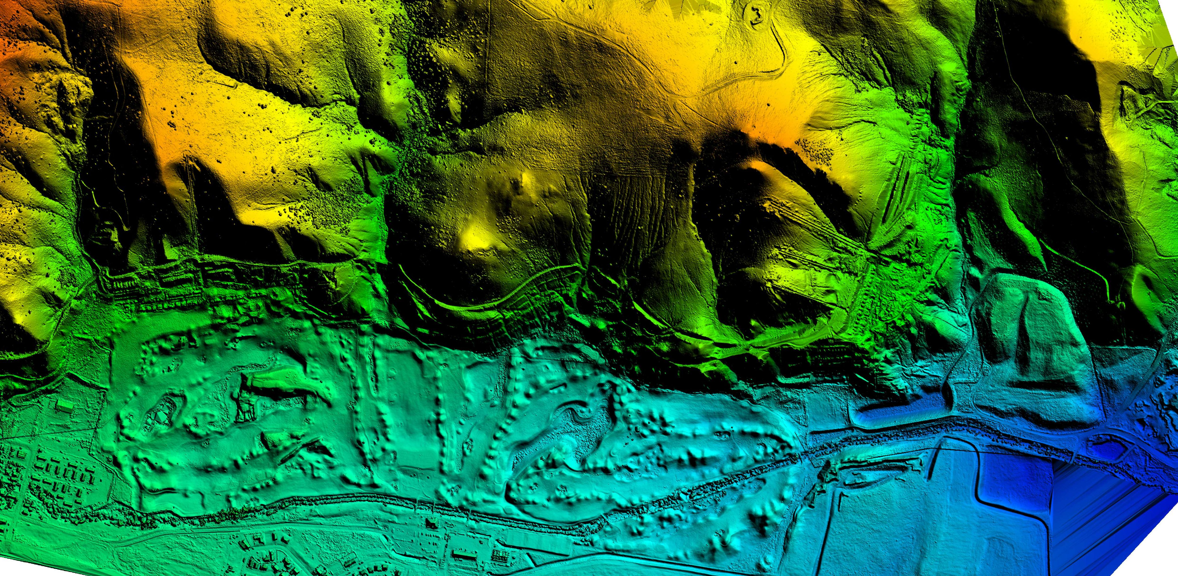
Since entering the UAS market, WET has established itself as a premier provider of UAS services in Montana and the Rocky Mountain region. WET has completed a variety of projects involving UAS data collection including: stockpile volume surveys, topographic surveys (used for site development, engineering design, environmental permitting, landfill life expectancy, etc.), open pit mine planning surveys, vegetation and weed mapping, and stream temperature mapping. WET currently owns two Sensefly eBees and a DJI Phantom multi-rotor platform. WET has access to multiple payloads for the eBees including RGB, NIR (great for vegetation mapping), thermal, and high definition video applications.
Contact WET today to learn more about specific applications and how a UAS survey/mapping project can bring value to your company.
WET contracted with a Montana county to assist them with 911 data collection and mapping. Recently, the county’s map book needed an update, as their current map book was produced using an extension that is no longer compatible with the latest version of ArcMap. WET developed a solution to use data driven pages (which is included with ArcMap) to produce a similar project without having to purchase an extension to ArcMap. We use data driven pages for many different projects in our organization, and ESRI’s online help is a great reference for getting to know how to use the data driven page tools in ArcMap. You can learn more about building map books with ArcGIS (here).
Here are the basics of making a map book with ArcMap
- Create a new base map with all the layers required for your map book.
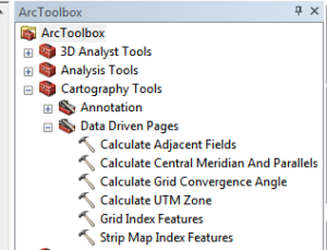
- Choose a suitable layer to use as an index (we used townships for our map book), or use ArcMap’s Data Driven Pages tools from ArcToolbox to build your index.
- There are two options in the toolbox to have ArcMap build an index layer for you:
- Grid Index Features (builds a polygon index based on an area)
- Strip Map Index Features (builds a polygon index based on a linear feature)
- Once your index is created, use the data driven pages setup button and the data driven pages toolbar to enable data driven pages, define your index layer, name field, sort field, and optional rotation, spatial reference, and page number fields. Also, use the extent tab to choose your margin and scale.
- Now in your layout view, use the Insert > Dynamic Text > to insert Data Driven page attributes into your layout.
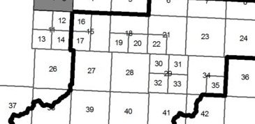
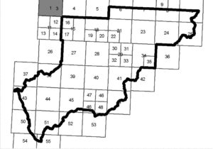
As mentioned earlier, we used section polygons for our index but the issue we had with this approach is that some areas had significantly more detail than others so it was necessary to divide the township polygons into sections to accommodate more details into the map. Some sections of the county have sparse population where it was sufficient to show the whole township for each page, but other areas needed to be split into 2 or 4 sections to accommodate additional details. Others have used parcel fabric tools to split the polygons into smaller sections, but the problem this option is that parcel fabric is not included in ArcMap basic. After some additional research, we discovered a python script for creating a fishnet that appeared to be just what was needed. After some testing and tweaking of the python script, we were able to divide by polygons! Here is a copy of the script:
from math import radians,sin,cos
from arcpy import env
env.overwriteOutput = True
inFC=arcpy.GetParameterAsText(0)
outFolder=arcpy.GetParameterAsText(1)
rectangle=r’in_memory\rectangle’
tempf=r’c:\junk\many.shp’
def showPyMessage():
arcpy.AddMessage(str(time.ctime()) + ” – ” + message)
def ShapeMake(pGon,angle):
ar=arcpy.Array()
a=radians(angle)
part=pGon.getPart(0)
for p in part:
x,y=p.X,p.Y
xN=cos(a)*x+sin(a)*y
yN=-sin(a)*x+cos(a)*y
pN=arcpy.Point(p.X,p.Y)
ar.add(pN)
pgonRotated=arcpy.Polygon(ar)
return pgonRotatedtry:
arcpy.MinimumBoundingGeometry_management(inFC,rectangle,
“RECTANGLE_BY_WIDTH”, “NONE”, “”, “MBG_FIELDS”)
m,n=0,0
with arcpy.da.SearchCursor(rectangle, (“SHAPE@”,”MBG_Orientation”)) as rows:
for row in rows:
shp,angle = row
onside=ShapeMake(shp,-angle)
extent=onside.extent
origPoint=’%s %s’ %(extent.XMin,extent.YMin)
yPoint=’%s %s’ %(extent.XMin,extent.YMax)
endPoint=’%s %s’ %(extent.XMax,extent.YMax)
arcpy.CreateFishnet_management(tempf, origPoint,yPoint,
“0”, “0”, 5, 5,endPoint,
“NO_LABELS”, “”, “POLYGON”)
arcpy.AddField_management(tempf, “Rotation”, “DOUBLE”)
arcpy.AddField_management(tempf, “Label”, “Text”, 25)
arcpy.AddField_management(tempf, “Grid”, “Text”, 5)
m+=1
with arcpy.da.UpdateCursor(tempf, [“SHAPE@”,”Rotation”,”Label”,”Grid”]) as rows:
for row in rows:
shp = row[0]
rollBack=ShapeMake(shp,angle)
row[0]=rollBack
row[1]=angle
row[2]=str(m)
m+=1
row[3]=str(n)
rows.updateRow(row)
n+=1
m=1
arcpy.CopyFeatures_management(tempf, ‘%s%sfnet_%s’%(outFolder,os.sep,str(n).zfill(4)))
except:
message = “\n*** PYTHON ERRORS *** “; showPyMessage()
message = “Python Traceback Info: ” + traceback.format_tb(sys.exc_info()[2])[0]; showPyMessage()
message = “Python Error Info: ” + str(sys.exc_type)+ “: ” + str(sys.exc_value) + “\n”; showPyMessage()
This script is designed to run with a toolbox in ArcMap. To get it to work for you, simply create a toolbox, edit the variables in the script and run! Here is what our final output looks like.
Now on to printing map books!
To learn more about WET’s 911 mapping capabilities and other GIS services, call Jeff LeProwse at (406) 782-5220 or visit our website at www.waterenvtech.com/services/gis-consulting.
Since its inception in 2000, WET has grown from a highly specialized group of groundwater professionals into a full-service environmental and engineering consulting firm with office locations in Butte, Anaconda, Bozeman, Great Falls, and Kalispell, Montana and Sheridan, Wyoming.

