UAV Remote Sensing for Noxious Weeds
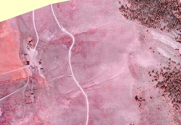
WET completed an aerial vegetation survey for a private ranch owner in southwestern Montana to map noxious weed densities. WET used the eBee RTK UAV equipped with a near-infrared camera to collect data to estimate densities of spotted knapweed. The near-infrared (NIR) photographs were processed using Postflight Terra 3D software. The software was used to generate a NIR reflectance orthomosaic and the normalized difference vegetation index (NDVI) which indicates plant photosynthetic activity. WET utilized GIS software to then analyze the images to identify and quantify knapweed. This information was provided to the client in order to develop a weed management plan.
The methods employed by WET have long been used with low resolution near-infrared satellite imagery to identify certain species of plants, but using high resolution photographs obtained from UAVs is a relatively new practice. WET stays abreast on current research that is revealing new and inventive ways of identifying and quantifying plant species using UAV obtained data in order to deliver the highest quality results and deliverables to its clients.
