Ore Stockpile UAV Survey
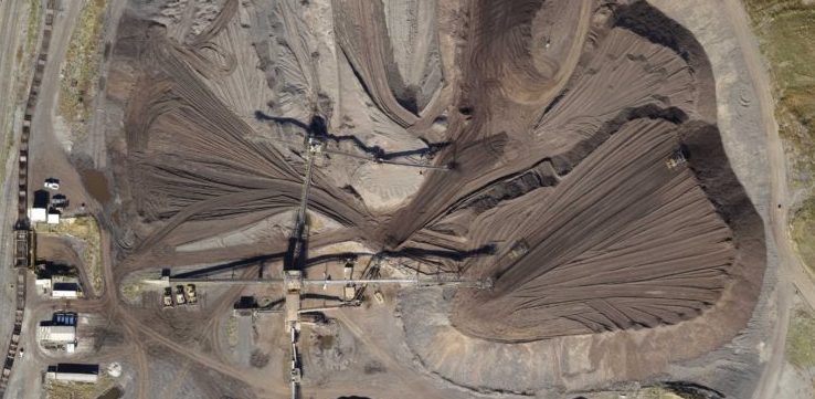
WET completed an aerial topographic survey for an industrial facility to determine the volume of an ore stockpile. WET used the eBee RTK UAV to collect high-resolution aerial photographs of the stockpile (flight area was approximately 110 acres). The photographs were processed using Postflight Terra 3D software. The software was used to generate a 3D densified point cloud, digital surface model, and an orthomosaic. The results from Postflight Terra 3D yielded an average ground sampling distance (GSD) of 1.3 inches and the ground control point root-mean square error values were less than 0.02 feet for X, Y, and Z. These indicate high quality and accurate results. The digital surface model was used to estimate the volume of the stockpile. However, due to the presence of several large conveyors and vehicles on the stockpile, these areas of the model were removed (scrubbed) using Lidar data mapping software. Once these areas were removed from the model, the stockpile volume was estimated and delivered to the client.
By using the UAV aerial survey to estimate the stockpile volume, WET reduced field survey time by approximately 90%. WET also greatly reduced the safety risk associated with the survey by avoiding personnel walking the steep and rugged terrain of the stockpile. Additionally, due to the high density of 3D data points associated with the UAV survey, WET was able to deliver a more accurate volume estimation than traditional ground survey methods feasibly allow.