UAV AERIAL MAPPING AND LIDAR
Save Time & Money—Get Better Data
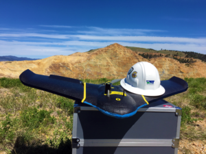
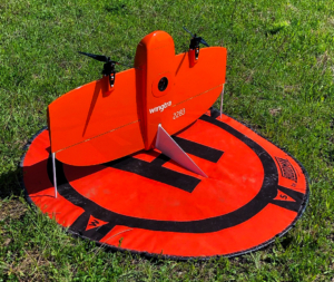
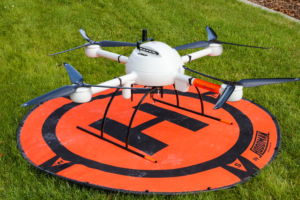
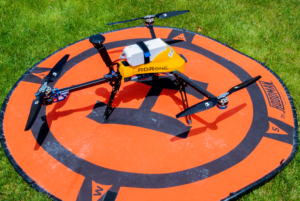
WET has been on the leading edge of UAV aerial surveying and mapping since 2015. WET recently expanded its capabilities to include UAV Lidar. WET’s fleet of drones has grown to include multiple fixed-wing and multi-rotor drones enabling WET to cater to all your aerial mapping needs. WET’s latest additions include Microdrones’ mdLidar1000 system, Vision Aerial’s RDRone with a FLIR Duo Pro R thermal camera, and the WingtraOne. The mdLidar1000 allows for collecting high-resolution 3D point clouds and accurate topography data on heavily vegetated sites. The RDRone with the FLIR Duo Pro R works great for thermal mapping and inspections. The WingtraOne captures imagery at 0.6 inches per pixel (GSD) while flying at an altitude of 400 feet and enables WET to map thousands of acres in a day with unprecedented levels of precision and accuracy.
WET’s UAVs capture aerial data to produce survey-grade orthomosaics and 3D point clouds. UAV’s have numerous applications for survey/engineering, GIS, agriculture, energy/mining, environmental monitoring, BIM/Construction, inspections, and more. Using professional software packages, WET creates 3D models (Lidar and Photogrammetry) down to 0.1-foot accuracy.
Outputs & Deliverables
WET tailors deliverables for each project, depending on client needs.
Some examples include the following:
- 3D Point Cloud (las, csv, etc.)
- DTM (las, dwg, dxf, xml, etc.)
- Contours (dwg, dxf, etc.)
- Orthomosaic Image (tiff, jpg)
- Vegetation Indices (tiff)
- Maps (pdf, hard copy, interactive web map)
- Temperature Indices (tiff)
- HD Video (mp4, wmv, etc.)
Application Examples
- Stockpile Surveys
- Mine Planning/Topography
- Site Development
- Engineering Design
- Environmental Restoration Monitoring
- Construction Progress Monitoring
- Landfill Topography
- Vegetation Mapping
- Stream Temperature Mapping
- Aerial Inspections
- Cultural Resources/Archaeology
- High Definition Video
- Erosion Analysis/Investigation/Monitoring
Superior Site Characterization
- Risk Reduction
- Rapid Data Acquisition (~100 acres per 30 min flight)
- Higher Data Resolution (<1in GSD)
- Lower Costs
- Unique Aerial Perspective
- Survey Inaccessible Locations
- No Interruption to Operations
- Multiple Data Types
WET has highly experienced UAV pilots and data processing/analysis experts. Part 107 certified pilots at WET, with hundreds of hours of in-flight project experience, have surveyed over 43,000 acres during more than 700 separate flights. Professionals at WET adhere to FAA regulations to assure flight missions are executed safely and efficiently. In addition, WET has a team of engineering, GIS, and CAD professionals highly experienced in extracting the most from UAV data through data processing and post-processing analysis.




TOM MINER BASIN RESIDENTIAL TOPO SURVEY—BOZEMAN, MONTANA
ECHO LAKE 120 ACRE LIDAR PROJECT PROJECT—BIGFORK, MONTANA