MULTIPLE GIS PROJECTS FOR MDEQ
Montana

WET has completed several large-scale watershed assessment and data collection projects on behalf of the Montana DEQ in support of Total Maximum Daily Load (TMDL) development. The scope of these projects was to conduct assessments on the unpaved road network within watersheds of multiple TMDL Planning Areas (TPA), including the Lower Clark Fork, Bitterroot, Tobacco, Yaak, Upper Jefferson, Little Blackfoot, and Lower Gallatin. WET performed modeling to estimate sediment loads delivered to 303(d) listed streams from unpaved road networks in the respective watersheds to identify potential sediment load reductions that could be realized from installing specific road network Best Management Practices (BMPs). WET acquired updated base data and developed GIS layers and summary statistics showing statistics for 303(d) listed streams including total number of road/stream crossings and length of road, summarized by ownership, general landscape setting and road type. Road crossing density and road length density were calculated for each sub watershed within the TPA and summary statistics were calculated using a Microsoft Access database.
A sampling plan was implemented and executed with the DEQ to capture a statistical sampling of roads within stratified categories of road source type, ownership, soil types, etc. A field assessment was conducted using vehicle mounted GPS/Laptop units running ArcPad Software customized with applets and data collection forms to collect site specific road and culvert data to populate the WEPP: Road sediment model, developed by the US Forest Service. Modeling was conducted on road crossings to determine predicted sediment load delivered to streams from the unpaved road network. In addition, culverts were screened using USFS protocol to determine failure potential and the possibility of blocking fish passage. Reports were delivered to MDEQ documenting the methods employed and the loading estimates derived based on the GIS information and data collected which included tables of sediment load estimates to the watershed’s tributaries from roads and crossings, potential sediment load reductions under an ideal management scenario and specified load calculation and extrapolation process and decision criteria, including rationale and all processes used.
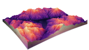
WET was selected by Montana DEQ to complete upland sediment assessment and modeling projects in two separate TMDL Planning Areas, including the Flint Creek and Lower Gallatin River watersheds. This was GIS-based project that involved incorporating multiple datasets into a GIS model and estimating soil erosion from upland sources using the Revised Universal Soil Loss Equation (RUSLE). Data sources included rainfall factor, soil erodibility, digital elevation models, land cover, and crop management. These sources were combined within the GIS model with a soil delivery factor and riparian health data to estimate soil delivery to streams from upland sediment erosion. A modeling scenario was applied to estimate the volume of sediment that could be reduced to streams through best management practices that improve riparian health condition.
These projects demonstrate the ability of WET staff to analyze watershed scale data in a GIS format, including data relating to water quality, climate, geology, soil, vegetation, and land use, which would be critical for evaluating watershed scale effects on water quality in this proposal. Throughout our history of working on complex DEQ projects, WET has demonstrated the ability to maintain a high quality of technical work while providing deliverables under tight timeframes.


